One of South East Queensland’s most important river catchments is being thrown a lifeline with local councils joining together to boost efforts to improve conditions in the Bremer River.
Launched as part of the Resilient Rivers Initiative, the Bremer River Catchment Action Plan will deliver a long term and strategic plan to combine the efforts and resources of all major stakeholders into one comprehensive strategy for the future.
South East Queensland councils have also contributed more than $2 million to the Resilient Rivers Initiative to support the delivery of high priority projects, as identified by the Bremer River Catchment Action Plan and others across the region.
Brisbane Lord Mayor and Council of Mayors (SEQ) Chair, Cr Graham Quirk, said the Bremer River Catchment Action Plan represented the first step in a strategic and coordinated approach to future-proof the Bremer River.
“The Bremer River is not only vital for the Scenic Rim and Ipswich communities, but is a major contributor to the Brisbane River and our iconic Moreton Bay. It deserves a dedicated plan to ensure its social, economic and environmental value is not overlooked,” he said.
The job of improving and protecting the Bremer River is too big for any one council or community group, only a coordinated approach can achieve this.
“This plan will ensure the funds invested in the Bremer River Catchment deliver the biggest return for the community.
“In addition to developing the Bremer River Catchment Action Plan, local councils have contributed more than $2 million to ensure this planning leads to real on-ground actions across South East Queensland.”
Ipswich City Council Interim Administrator Greg Chemello said the Bremer River Catchment Action Plan was a collaborative effort involving a range of organisations, as well as State and local governments.
“The health of the Bremer River has been a particular concern and we need the strategic and coordinated cross-boundary involvement of many stakeholder groups to improve its condition,” Mr Chemello said.
These catchment action plans make it easier for Council to work alongside other organisations on co-funded projects. We share a clear vision and have the same goals.
Scenic Rim Mayor Greg Christensen added that while we can’t stop severe weather events from impacting the Bremer River catchment, more can be done to boost the resilience of our rivers and creeks to reduce the damage caused.
“As we’ve seen with past weather events and flooding in the region, the Scenic Rim experiences widespread loss of valuable agricultural soils and damage to bridges and culverts,” he said.
The Bremer River Catchment Action Plan will build resilience in our rivers and creeks, reducing the velocity of water during these events, keeping valuable agricultural soil on our farms, and better protecting our assets.
“These projects complement the ongoing partnership of councils and landowners via the River Improvement Trusts, to preserve a resource that is important for all.”
The Bremer Catchment Action Plan has been developed as part of the Resilient Rivers Initiative, a coordinated approach to the improvement and management of South East Queensland’s catchments and waterways.
The Bremer River Catchment is about 2032 sq km and flows through Scenic Rim Regional Council and Ipswich City Council areas to where it meets with the Brisbane River at Riverview.
Read the Bremer River Catchment Action Plan

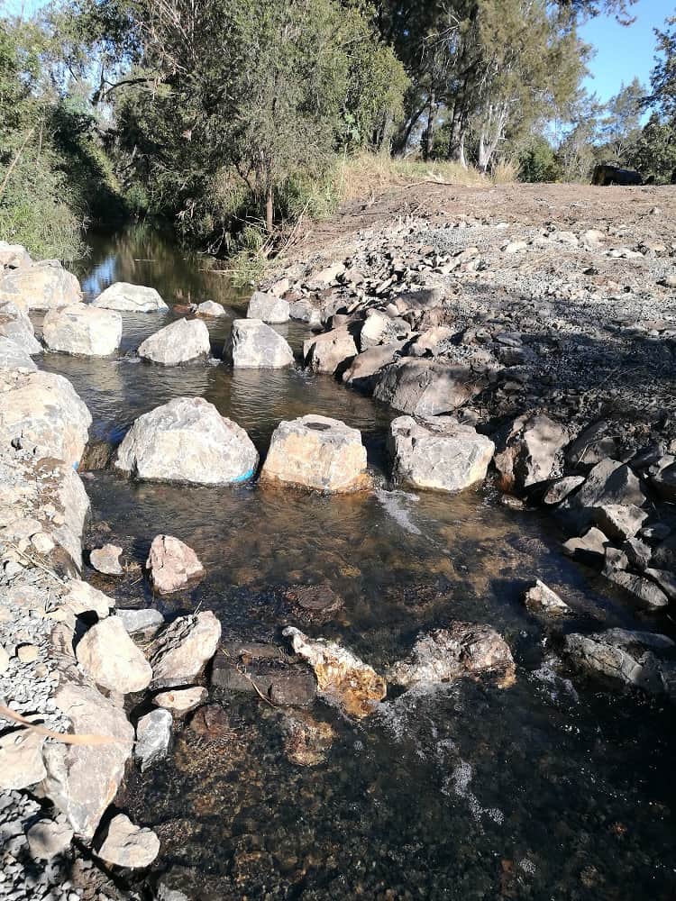
Removal of a fish barrier at Worley Park, Raceview
Taking action in Ipswich
Ipswich City Council is well positioned with the Bremer River Catchment Action Plan because actions relating to council are already moving ahead, with some part of regular council services, and others already funded or identified for future investment.
Actions completed include stage one of Small Creek, the Jim Donald Wetlands, targeted revegetation with council’s Habitat Connections Program and removal of fish barriers in Bremer River and Bundamba Creek.
Future actions include improving bank stability in Bundamba and Ironpot creeks, promoting best practice sediment and erosion control in development areas such as Ripley Valley and flood mitigation options.

