
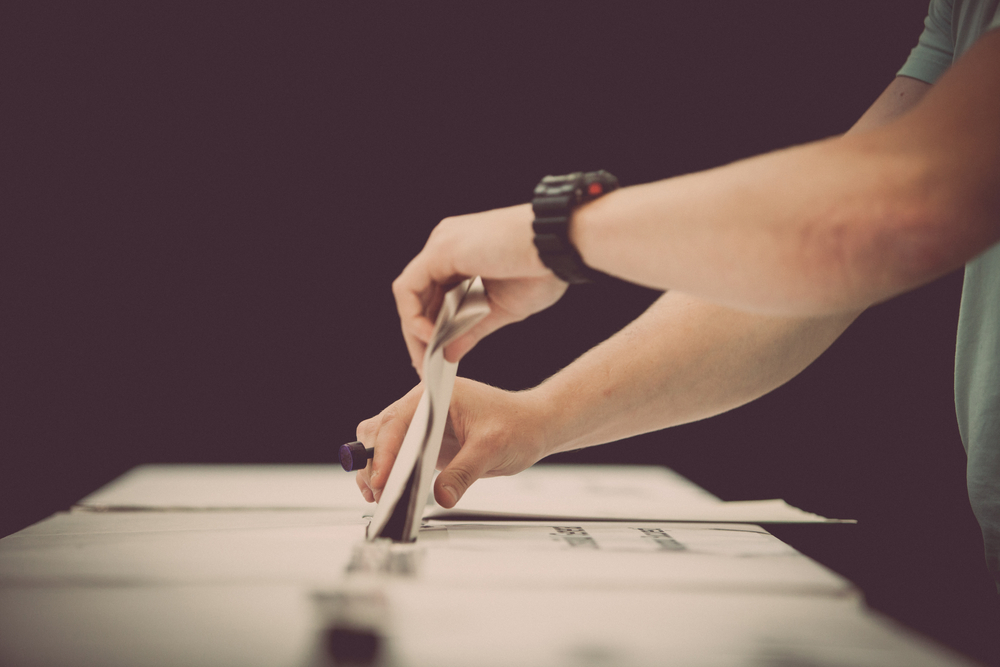
Polling day for the 2024 council elections is this Saturday, 16 March.
Voting is compulsory and 47 polling booths will be open across the four divisions which make up the Ipswich local government area.
On polling day, booths will be open from 8am to 6pm.
Early voting is available until today (15 March, 2024), with details available on the Electoral Commission Queensland website.
Bringing your maroon voter information card that was posted in the mail by the Electoral Commission of Queensland will help speed up the voting process.
On 16 March, many residents of the Ipswich City Council area will also be voting in the State Government by-election for the seat of Ipswich West.
Electoral Commissioner Pat Vidgen said voters would be voting for a new State Member of Parliament on the same day they vote for their council representatives.
Division 1 voting booths
Deebing Heights State School, 81 Rawlings Road, Deebing Heights
Ripley Central State School, 103 Binnies Road, Ripley
Grandchester State School, 35 School Road, Grandchester
Raceview State School Hall, 96 Wildey Street, Raceview
Whitehill Church of Christ, 219 Whitehill Road, Raceview
Redbank Plains State School Hall, 39 – 53 School Road, Redbank Plains
Redbank Plains State High School, Performing Arts Hall, 136 Willow Road, Redbank Plains
Ripley Valley State Secondary College, Raptor Dome, 18 Parkway Avenue, South Ripley
Amberley Girl Guides Hut, 21 Wellington Rise, Willowbank
Amberley District State School Hall, 37 Deebing Creek Road, Yamanto
About Division 1
Division 1 is the largest geographically of the four divisions and amalgamates both rural and urban suburbs. The division covers a geographic catchment of 61,148 ha (611 km2) and is oriented in a east-west direction spanning from Grandchester and Mount Mort in the west to Redbank Plains and White Rock in the east.
The suburbs of Division 1 include Blackstone, Calvert, Deebing Heights, Ebenezer, Flinders View, Goolman, Grandchester, Jeebropilly, Lower Mount Walker, Mount Forbes, Mount Mort, Mount Walker West, Mutdapilly, Peak Crossing, Purga, Raceview, Redbank Plains, Ripley, South Ripley, Swanbank, White Rock, and Willowbank.
Division 2 voting booths
Augusta State School, 60 Brittains Road, Augustine Heights
Bellbird Park State Secondary College, 2 Alesana Drive, Bellbird Park
Camira State School Hall, 184-202 Old Logan Road, Camira
Karate Hall, 83 Old Logan Road, Camira
St Francis Xavier Primary School Hall, 6 Church Street, Goodna
Woodcrest State College Auditorium, 38 Nev Smith Drive, Springfield
Brighton Homes Arena, 16 Eden Station Drive, Springfield Central
Springfield Lakes State School Hall, 63 Springfield Lakes Boulevard, Springfield Lakes
About Division 2
Division 2 is a mostly urban electorate situated in the eastern end of the City of Ipswich. The division is bounded by the Brisbane River in the north, Brisbane and Logan City boundaries in the southeast, White Rock Spring Mountain Conservation Estate in the south, Redbank Plains Road and Kruger Parade in the west.
It encompasses the suburbs of Augustine Heights, Bellbird Park, Brookwater, Camira, Carole Park, Gailes, Goodna, Spring Mountain, Springfield, Springfield Central, Springfield Lakes and Redbank. Division 2 wholly includes all suburbs except for Goodna and Redbank with a part of Goodna (west of Stuart Street) contained in Division 3 and an area of Redbank (situated north of Eagle Street and East of Kruger Parade) included in the Division.
Division 3 voting booths
Oasis Church of Christ Bundamba 25 Byrne Street, Bundamba
Bundamba State School, 221 Brisbane Road, Bundamba
Collingwood Park State School Hall, 12-16 Burrel Street, Collingwood Park
Woodlinks State School Woodlinks Way, Collingwood Park
Ipswich East State School 18 Jacaranda Street, East Ipswich
St Francis Xavier Primary School Hall 6 Church Street, Goodna
Ipswich Central State School Hall, 2A Griffith Road, Ipswich
Leichhardt State School Hall, 72 Samford Road, Leichardt
Glebe Road Community Kindergarten & Pre-School, 52 Glebe Road, Newtown
Ipswich Uniting Church Hall, 114 Jacaranda Street, North Booval
Immaculate Heart Primary School, Chubb Street, Leichardt
Redbank State School, 9 Brisbane Road, Redbank
Riverview Community Centre, 138 Old Ipswich Road, Riverview
Blair State School Cribb Street, Sadliers Crossing
Silkstone State School Prospect Street, Silkstone
Ipswich West State School Kennedy Street, West Ipswich
About Division 3
Division 3 is oriented in a west-east direction with Brisbane Road and the Ipswich train line through its core. In the western extent is Leichhardt and One Mile, with the northern extent largely bound by the Bremer and Brisbane Rivers.
The southern boundary follows Bundamba Creek north of Blackstone, the Cunningham Highway and Redbank Plains Road. The eastern extent is bordered by Goodna Creek, the Ipswich Motorway and Stuart Street. The division includes Basin Pocket, Booval, Bundamba, Coalfalls, Collingwood Park, Dinmore, East Ipswich, Eastern Heights, Ebbw Vale, Goodna (west of Stuart Street), Ipswich, Leichhardt, New Chum, Newtown, North Booval, One Mile, Redbank (excluding houses situated east of Kruger Parade), Riverview, Sadliers Crossing, Silkstone, West Ipswich, Woodend, and Wulkuraka (south of the railway line).
Division 4 voting booths
Brassall Congregational Church Hall, 3 Jellicoe Street, Brassall
Ipswich State High School Hall, 1 Hunter Street, Brassall
Churchill State School Hall, Brisbane Street (off Warwick Road), Churchill
Haigslea State School, 760 Thagoona Haigslea Road, Haigslea
Karalee State School Hall, 77 Arthur Summervilles Road, Karalee
Marburg State School, Louisa Street, Marburg
Ipswich North State School Hall, Lawrence Street, North Ipswich
Pine Mountain Hall, 840 Pine Mountain Road, Pine Mountain
St Joseph’s School Hall, 42 Pine Mountain Road, North Ipswich
Rosewood State School, School Street, Rosewood
Tivoli State School, 108 Mt Crosby Road, Tivoli
Walloon State School, 528 Karrabin-Rosewood Road, Walloon
Amberley District State School Hall, 37 Deebing Creek Road, Yamanto
About Division 4
Division 4 amalgamates both rural and urban suburbs and contains areas with significant projected growth, such as Marburg and Rosewood. The division covers a geographic catchment of 34,225 ha (342 km2).
The division is oriented in a west-east direction and includes the suburbs of Amberley, Ashwell, Barellan Point, Blacksoil, Brassall, Churchill, Chuwar, Haigslea, Ironbark, Karalee, Karrabin, Lanefield, Marburg, Moores Pocket, Mount Marrow, Muirlea, North Ipswich, North Tivoli, Pine Mountain, Rosewood, Tallegalla, Thagoona, The Bluff, Tivoli, Walloon, Woolshed, Wulkuraka (north of the railway line), and Yamanto.
Not all voting booths have the same level of disability access. Details on disability access are available here.